Coyote Valley Open Space Preserve
About this Preserve
Coyote Valley Open Space Preserve
Alerts & Closures
Hours:
Sunday - Saturday | 7:00 a.m. - 5:45 p.m.
Facilities:
- Accessible all-gender restroom
- Picnic tables
- No trash cans
- No drinking water
Location:
550 Palm Ave., Morgan Hill, CA
Parking & Transportation:
- Free parking lot (27 regular spaces, 2 accessible spaces)
- Free horse trailer parking available. Contact us to reserve horse trailer parking (optional).
Accessibility accommodations:
Everyone deserves equitable access to nature. Please visit our Accessibility page or email ada@openspaceauthority.org for questions, concerns or specific accessibility resource requests.
Emergency Information:
For emergencies or to report suspicious activity, please call 911.
Due to the sensitivity of this habitat, dogs and drones are not permitted anywhere on the preserve.
Trail maps are georeferenced for use in Avenza Maps
Know Before You Go
Preserve Highlights & Features
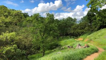
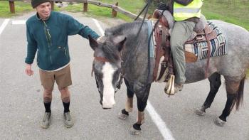
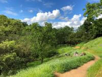
Coyote Valley Open Space Preserve is located at the western edge of the Coyote Valley, which provides a greenbelt between San José and Morgan Hill. While only 20 miles from downtown San José, this preserve offers true rural and breathtaking nature experiences for all. Recreation amenities include a multi-use trail for hikers, mountain bikers and equestrians.
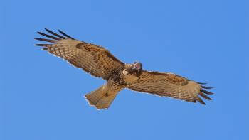
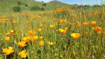
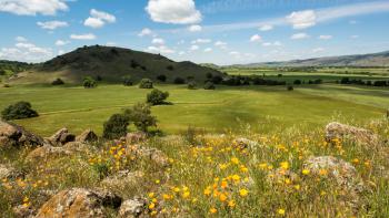
The 4-mile Arrowhead Loop Trail meanders past rare serpentine rock outcroppings, through grasslands and forest canopy composed of oaks and California bays and runs along seasonal creeks that spring alive in winter. Enjoy stunning views of Mount Hamilton, Mount Umunhum and the entire Coyote Valley. A favorite location for birdwatching, Coyote Valley is home to soaring red-tailed hawks, golden eagles, yellow-billed magpies and many other species. Spring months bring dazzling wildflowers blanketing hillsides and meadows. In 2015, the Arrowhead Trail was certified by the National Park Service as an official interpretive site of the historic Juan Bautista de Anza Trail, providing visitors an opportunity to learn more about the expedition.
Coyote Valley is one of the Open Space Authority's top 10 priority natural landscapes remaining in Santa Clara County that is critically important to protect from development. The area’s many conservation values include resilience to climate change, a rich cultural history, valuable water resources, exceptional recreational opportunities, farm and ranchland and critical wildlife linkages that allow animals to cross between the Santa Cruz Mountains and the Diablo Range. Learn more about our work in Coyote Valley.
Upcoming Events at this Preserve
Funding for this Preserve
In 2010, the Open Space Authority permanently protected Coyote Valley Open Space Preserve for $3.5 million, paid for by the agency.
The Open Space Authority is currently making accessibility improvements to the Heart’s Delight Trail and other facilities at Coyote Valley Open Space Preserve. The total cost of the project is $1.4 million, with $800,000 funded by the Federal Community Project Funding, $200,000 from Santa Clara Valley Water District’s Safe, Clean Water Project D3 Trails Grant Program and $400,000 from the Open Space Authority’s Measure Q and Measure T.
